Walks in and around Nantgwynant
... from short strolls to day long hikes
The walks
The walks all allow the walker to experience the beauty of the Nantgwynant Valley and surounding area. For a full description and directions for each walk refer to the book. The walks are divided into four main groups:
- Yr Wyddfa (Snowdon) area walks
- Moelwyns area walks
- Beddgelert area walks
- A little further from Nantgwynant
Be weather wiseCheck the Met-Office mountain weather service / detailed forecast for Eryri / Snowdonia before setting out |
Yr Wyddfa (Snowdon) area walks
YR WYDDFA (SNOWDON) AREA WALKS
Yr Wyddfa (Snowdon) is perhaps one of the most famous mountains in Wales, and maybe in the entire United Kingdom.
Thousands of people come to climb to the summit of Yr Wyddfa each year, however there are many interesting walks to be enjoyed on the lower slopes of the Yr Wyddfa range taking in woodlands and waterfalls, as well as open mountainside and fine views of other classic summits in the Eryri (Snowdonia) National Park. These lower mountainsides are also rich in history and the heritage of the area, and picturesque old buildings and other remains can be seen on many of the walks in this section .
From many of these walks it is possible, on a clear day to see the famous summits Crib Goch and Y Lliwedd as well as Yr Wyddfa itself.
Some of the highlights in this area:
- Watkin path
- Watkin path waterfalls and pools (falls fo Afon Cwm Llan)
- Industiral heritage of Snowdon South Quaries
- Fine views on a clear day
- Craflwyn historic woodlands and Enrys Dians
- Craflwyn National Trust information centre
- Historic Cwm Dyli hydro-electric power station
- Llyn Gwynant
TO THE AFON MERCH WATERFALLS (VIA THE LOWER WATKIN PATH WATERFALLS)
Featured in: Walks in and around Nantgwynant
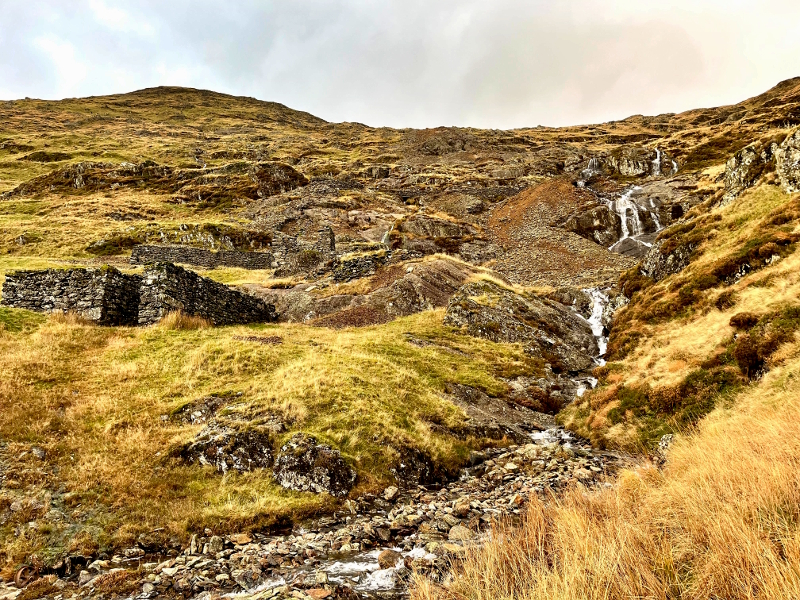
This steady climb through woodland and across mountainside first passes the expansive waterfalls of Afon Cwm Llan next to the lower section of the Watkin Path before heading further up hill to the waterfalls of Afon Merch just bellow the old mine workings below Lliwedd Bach. On a clear day the route offers fine views over Tremadoc Bay and the Moelwyn summits.
The Old Copper Mine by Afon Merch dates back to 1806. The copper ore was not smelted on site, but mostly sent to Swansea, initially by horse and cart to Porthmadog and then, from there, by boat. The mine closed around 1867 due the depletion of copper deposit.
|
Start location |
Watkin Path car park next to A498 (Toilets at car part, not open 24 hours) |
|
Start grid reference |
SH 628 507 |
|
Length |
8.8 kilometres (5.4 miles) |
|
Total ascent |
474 metres (1554 feet) |
|
Typical duration |
2 hours 40 mins |
|
Suitable for |
Enthusiastic rambler (Sunday strollers who don’t mind an up hill route can following route description points 1 – 4, and then point 8) |
HAFOD Y PORTH LOOP
Featured in: Walks in and around Nantgwynant
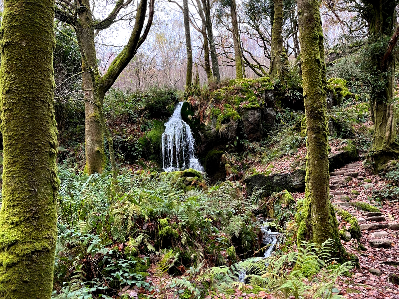
Passing the Sygun Copper Mine, Craflwyn Hall and finishing on the historic Watkin Path this route offers plenty of history as well a woodland, waterfalls and fine mountain views (on a clear day!). Dinas Emrys, a distinctive small hill visible from serveral sections of the walk is the site of an old Iron Age fort, this small hill is shrouded in myths and legends. For example, some tell of how a castle was erected by Llewelyn the Last to guard the road, that a pool under the fort contained two dragons (the white dragon of the Saxons and the red dragon of the Welsh) and that this was, in legend, the setting of a meeting of the warlord Vortigern and the youthful Merlin.
Much of this area was originally part of the Hafod y Llan Estate which has been a hill farm for at least 200 years. Hafod y Llan was bought by the National Trust in 1998.
|
Start location |
Lay-by next to A498 south end of Llyn Dians |
|
Start grid reference |
SH 613 494 |
|
Length |
10 kilometres (6.2 miles) |
|
Total ascent |
360 metres (1182 feet) |
|
Typical duration |
3 hours |
|
Suitable for |
Confident navigator |
NANTGWYNANT TO PEN-Y-PASS LOOP
Featured in: More walks in and around Nantgwynant
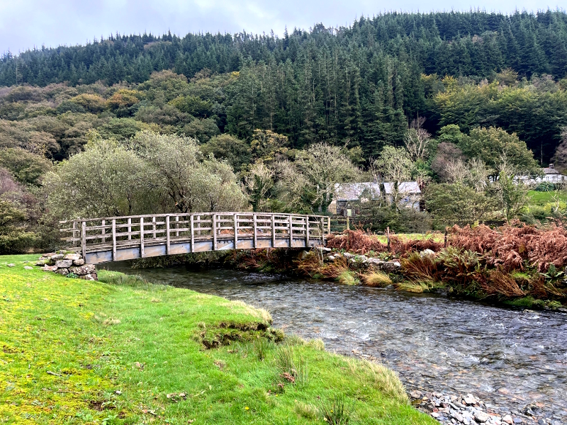
A walk in the upper part of the Nantgwynant valley, passing through woodland and over lower mountainside with fine views over Llyn Gwynant (lake) and down the valley toward Beddgelert. The highest point of the walk reaches Pen-y-pass before returning in a loop to the north end of Llyn Gwynant. The route passes the historic Cwm Dyli hydro-electric power station and the pipeline that supplies water from Llyn Llydaw.
Cwm Dyli is the oldest hydro-electric power station in Britain, initially built to supply electricity for an electric railway through Nantgwynant. The railway was intended to connect slate quarries and mines in the area, but the work was abandoned. However, in 1906, the power station was commissioned to supply electricity to the National Grid and has been active ever since. Water for the power station comes from Llyn Llydaw approximately 320 metres above it. The water is carried from the lake through a tunnel and 30inch diameter, 2 kilometre long pipelines. Reportedly the pipeline featured in the James Bond film The World Is Not Enough.
|
Start |
‘Watkin Path car park in Nantgwynant’ |
|
Distance |
15.6 km |
|
Altitude Gain |
560 m |
|
Approx Time |
4h 50mins |
|
Rating |
Enthusiastic wanderers |
LLYN GWYNANT LOOP
Featured in: More walks in and around Nantgwynant
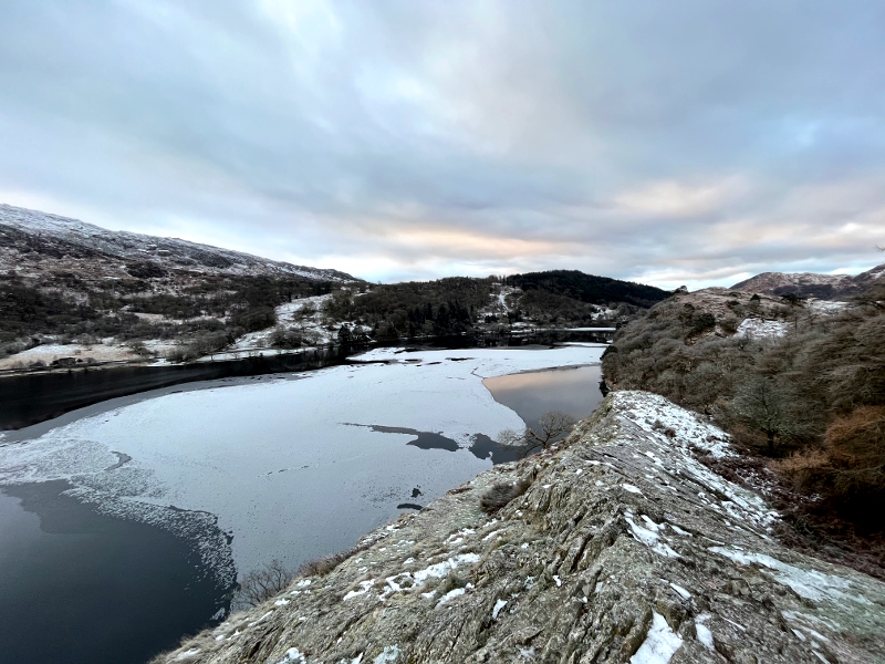
After climbing up hill along a quiet lane this route heads across open countryside and through woodlands before descending to Llyn Gwynant where the route continues to cross gently undulating open countryside and through more woodland to form a ‘circular’ walk with good views across the lake from many ‘view points’ along the route.
|
Start |
‘Watkin Path car park in Nantgwynant’ |
|
Distance |
10.6 km |
|
Altitude Gain |
220 m |
|
Approx Time |
2h 40 mins |
|
Rating |
Enthusiastic wanderers |
NANTGWYNANT TO BEDDGELERT FOREST LOOP (RETURNING ALONG THE NANTGWYNANT VALLEY)
Featured in: More walks in and around Nantgwynant
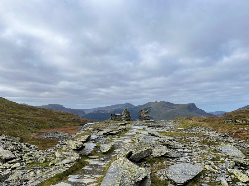
This walk starts out along the lower part of the historic Watkin Path (the first official public footpath in Britain) and passes a series of waterfalls before heading along an old tramway built to service the slate quarries on the south side of Yr Wyddfa. The route then heads up over the lower part of Yr Wyddfa’s south ridge and past the old Bwlch Cwm y Llan quarry with clear remains of the former quarry workings and buildings. The route descends to the Beddgelert Forest and follows a level route through the forest and then across open countryside to Beddgelert and returns along small lanes and footpaths past the Sygun copper mine and Llyn Dinas (lake) to the start.
|
Start |
‘Watkin Path car park in Nantgwynant’ |
|
Distance |
21.5 km |
|
Altitude Gain |
595 m |
|
Approx Time |
4h 30 mins |
|
Rating |
Enthusiastic wanderers |
EXPLORATION OF THE WATERFALLS AND INDUSTRIAL HERITAGE OF THE AFON CWM LLAN VALLEY
Featured in: More walks in and around Nantgwynant
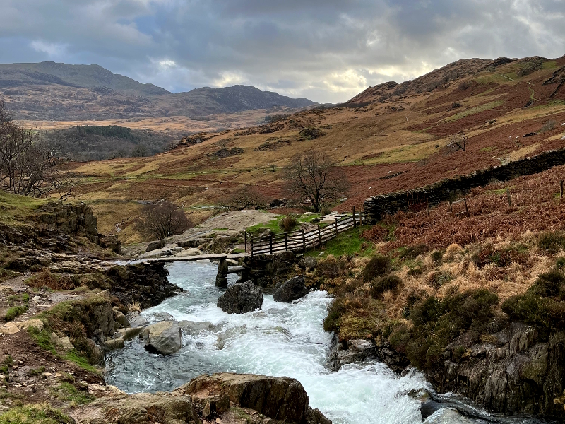
This shorter walk starts out through woodland along the lower part of the historic Watkin Path (the first official public footpath in Britain) and then open hillside, it passes a series of waterfalls follows the route of old tramways and paths passing some of the old quarry buildings and workings in the upper part of the valley as well as the historic Gladstone Rock.
The walk follows a ‘figure-of-eight loop to explore the Afon Cwm Llan valley set below the dramatic mountains of Yr Aran, Y Lliwedd and Yr Wyddfa (Snowdon).
|
Start |
‘Watkin Path car park in Nantgwynant’ |
|
Distance |
7.2 km |
|
Altitude Gain |
346 m |
|
Approx Time |
2h 30 mins |
|
Rating |
Enthusiastic wanderers |
CRAFLWYN WOODS AND UPLAND PASTURE LOOP
Featured in: More walks in and around Nantgwynant
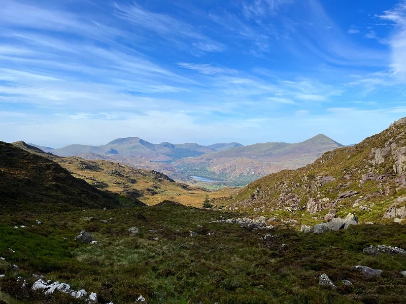
The walk passes the historic Dinas Emrys (former fort and place of history and legend, including ancient battles and dragons) and climbs through woodland before opening onto open countryside with views over Llyn Dinas and Beddgelert village. Along the route picturesque old ruined farm buildings (dating back to the 12th century), waterfalls and traces of tramways that were built to serve small mines and quarries now long since vanished can be seen. The start is also close to the Sygun Victorian copper mine (that stopped production in 1903) which, when open, offers tours and has a visitor centre and tea room.
|
Start |
Craflwyn Car Park [National Trust, with small visitor centre / history centre] or from the South End of Llyn Dinas |
|
Distance |
4.9 km |
|
Altitude Gain |
340 m |
|
Approx Time |
2h 40 mins |
|
Rating |
Enthusiastic wanderers |
Moelwyn area walks
MOELWYNS AREA WALKS
The Moelwyn mountain range (in Welsh, the Moelwynian), covers an area from Porthmadog to Moel Siabod near Capel Curig. The summits here are not as high as in some other Snowdonia ranges and the hills tend to be less frequented than some of the more famous mountains in the Snowdon and Glyderau areas. Never the less walks in this area can still offer fine views on a clear day from mountain to sea. The area is scattered with small lakes and streams, in parts heather covered hillsides can provide splashes of vivid colour when the heather is in flower.
Some of the highlights in this area:
- Industiral heritage of Sygun Copper mine and the Cwm Bychan mine
- Fine views on a clear day
- Views of Enrys Dians steeped in myth and legend
- High mountain lakes, streams and water falls (including Llyn Edno)
- Afon Glaslyn river from Nantmor to Beddgelert
- Llan Dinas
- Picturesque mountain farms and cottages
- Dolwyddelan Castle
LLYN DINAS TO SYGUN COPPER MINE LOOP
Featured in: Walks in and around Nantgwynant
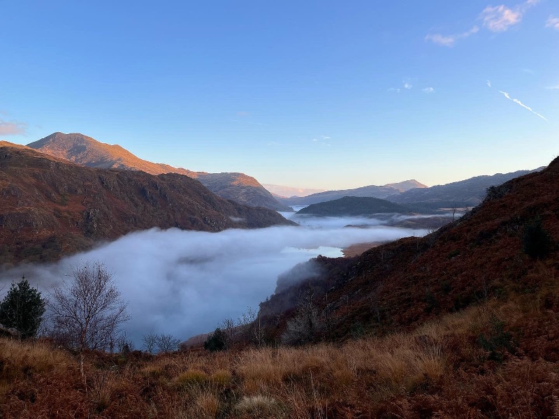
Starting off at Llan Dinas with fine views across the lake and towards the Snowdon range, this route includes a short climb to provide views along the Afon Glaslyn valley to Llyn Gwynant and beyond. The route returns via the Sygun Copper Mine.
|
Start location |
Lay-by next to A498 south end of Llyn Dians |
|
Start grid reference |
SH 613 494 |
|
Length |
4.3 kilometres (2.7 miles) |
|
Total ascent |
294 metres (965 feet) |
|
Typical duration |
1 hours 30 mins |
|
Suitable for |
Enthusiastic ramblers |
LLYN DINAS TO MYNYDD SYGYN LOOP
Featured in: Walks in and around Nantgwynant
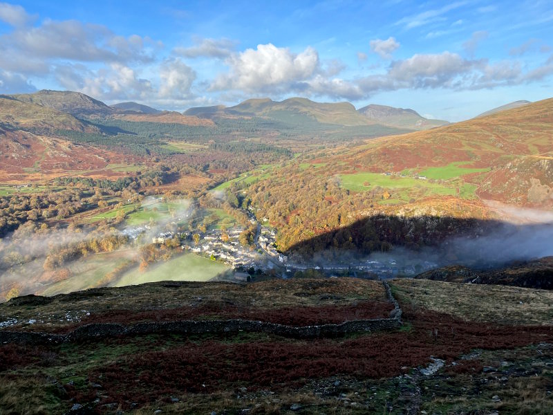
This is an extension to the “Llyn Dinas to the Sygun Copper Mine” route, which offers all the views and interest of that route and, in addition, the summit of Mynydd Sygyn with great views over Beddgelert (on a clear day).
|
Start location |
Lay-by next to A498 south end of Llyn Dians |
|
Start grid reference |
SH 613 494 |
|
Length |
6.4 kilometres (4 miles) |
|
Total ascent |
355 metres (1165 feet) |
|
Typical duration |
2 hours 10 mins |
|
Suitable for |
Enthusiastic ramblers |
LLYN DINAS TO ABERGLASLYN LOOP
Featured in: Walks in and around Nantgwynant
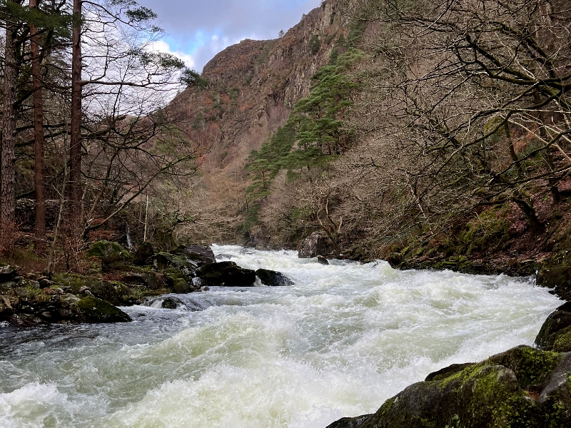
This is a longer extension to the “Llyn Dinas to the Sygun Copper Mine” route, which offers all the views and interest of that route and, in addition, a riverside walk along the Afon Glaslyn river with its rapids interspersed with wider calmer sections. Note that the path along the river is rocky in sections. As part of the return section of the route it passes through the pretty village of Beddgelert.
The (river) Afon Glaslyn has its source flowing from a lake high up on Yr Wyddfa (Snowdon), flows through Nantgwynant and Beddgelert and enters the Irish Sea at Porthmadog.
The route also passes the old Cwm Bychan Mine Workings and Ropeway. The remains of the old aerial ropeway pylons dating from the 1920s can be seen in the valley. These were used to transport extract from the mine to the processing plant at Nantmor (a distance of about 1.4 kilometres). The cable that carried the buckets was made of steel wrapped around a hemp rope core. The main area of the old mine is just to the west of the top station of the ropeway.
An optional extention to this route can be included to summit Moel y Dyniewyd, from where on a clear day there are fine views across the Snowdon and Moelwyns ranges, and out to the coastal edge of the National Park. This optional section of the route is steep in places and requires short sections of easy scrambling over rock, it adds 45 minutes, 2 kilometres / 1.2 miles with 114 metres / 375 feet of ascent to a route.
|
Start location |
Lay-by next to A498 south end of Llyn Dians |
|
Start grid reference |
SH 613 494 |
|
Length |
9 kilometres (5.6 miles) |
|
Total ascent |
422 metres (1385 feet) |
|
Typical duration |
3 hours |
|
Suitable for |
Enthusiastic ramblers |
LLYNDY ISAF / COED LLEWELYN LOOP
Featured in: Walks in and around Nantgwynant
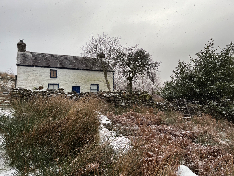
This short walk offers lake views, woodland, open hillside and a picturesque quiet lane. Maybe ideal for a summer evening or bright winter afternoon walk.
|
Start location |
Watkin Path car park next to A498 (Toilets at car part, not open 24 hours) |
|
Start grid reference |
SH 628 507 |
|
Length |
5.6 kilometres (3.5 miles ) |
|
Total ascent |
157 metres (518 feet) |
|
Typical duration |
1 hour 30 mins |
|
Suitable for |
Sunday strollers who don’t mind a bit of walking up hill / Enthusiastic ramblers |
AROUND YR ARDDU LOOP
Featured in: Walks in and around Nantgwynant
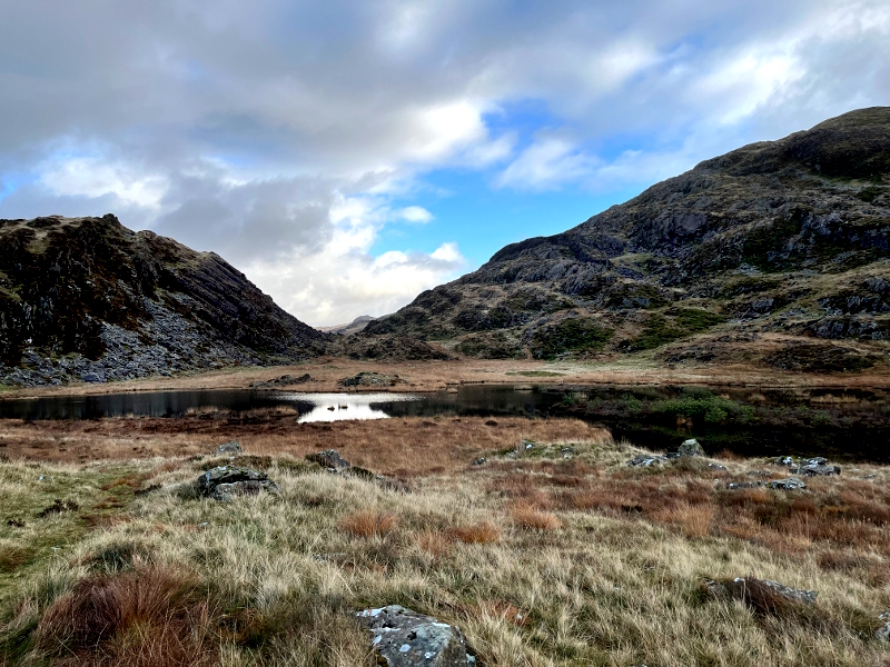
This route starts with a moderately steep climb, which rewards the walker with views of the coast on a clear day. The return section through old woodland valleys provides a contrast to the open mountainside of the first half of the route. The route also includes a short section of the Snowdonia Slate Trail. The Snowdonia Slate Trail is a ‘circular’ 83 mile trail that passes through all the major mountain ranges of the National Park via sites that were once centres of the slate industry.
|
Start location |
Watkin Path car park next to A498 (Toilets at car part, not open 24 hours) | Small car park near Gello-Lago |
| Start grid reference |
SH 628 507 |
SH 632 484 |
|
Length |
18 kilometres (11.2 miles) |
10.6 kilometres (6.57 miles) |
|
Total ascent |
664 metres (2180 feet) |
512 metres (1680 feet) |
|
Typical duration |
5 hours 10 mins |
3 hours 10 mins |
|
Suitable for |
Confident navigators |
|
MOEL MEIRCH (AND LLYN EDNO) LOOP
Featured in: Walks in and around Nantgwynant
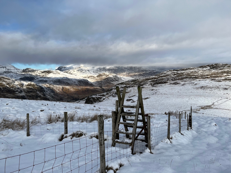
This walk starts off following a straightforward route along the western side of Llyn Gwynant (with some fine views over the lake and on to the mountains beyond) before crossing the A498 to the second section of the route, which requires careful navigation as it slowly climbs to the top of the valley just below the summit of Moel Meirch, from where there is an option to make a short ‘there and back’ extension to visit Llyn Edno, before descending back to Nantgwynant.
For a longer walk it is possible to extend this route by starting from the car park at the foot of the Watkin Path, but some walkers may prefer to start from the small car park close to Gelli Lago (starting from point 12 in the route description).
|
Start location |
Watkin Path car park next to A498 (Toilets at car part, not open 24 hours) |
|
Start grid reference |
SH 628 507 |
|
Length |
12 9 kilometres (8 miles ) |
|
Total ascent |
641 metres (2104 feet) |
|
Typical duration |
4 hours |
|
Suitable for |
Confident navigators |
NANTGWYNANT TO DOLWYDDELAN CASTLE LOOP
Featured in: More walks in and around Nantgwynant
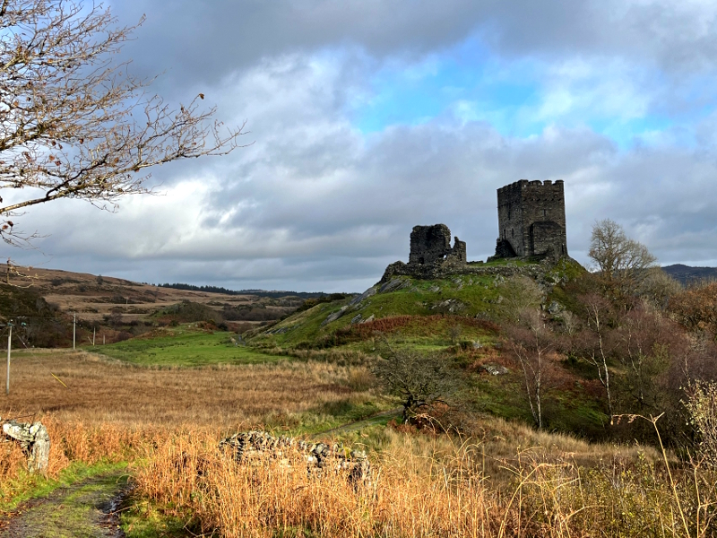
This route follows mountain and woodland paths with fine views (on a clear day) to journey from Nantgwynant, past Llyn Gwyant and then up into the Moelwyns to visit the isolated and historic Dolwyddelan Castle.
Dolwyddelan Castle built by Llywelyn ap Iorwerth (Llywelyn the Great). Llywelyn was prince of Gwynedd from 1195–1240, and Dolwyddelan Castle was purpose-built at the turn of the 13th century to protect the mountain pass, a popular route trade route at the time between Conwy and Cricieth. It is possible to wander into the ruins of the old castle (where there are information boards) and to explore.
|
Start |
‘Watkin Path car park in Nantgwynant’ |
|
Distance |
26.8 km |
|
Altitude Gain |
645 m |
|
Approx Time |
7h |
|
Rating |
Enthusiastic wanderers - day long walk |
LAKES AND VALLEYS LOOP
Featured in: More walks in and around Nantgwynant
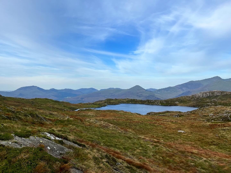
This walk passes numerous small lakes, and larger ones including Llyn Dinas and high above on the upper slopes of the walk Llyn Llagi and Llyn Edno, it also passes many valley streams and includes fine views (on a clear day) of sections of the Moelwyns and the Yr Wyddfa (Snowdon) range which is one the opposite side of the Nantgwynant valley. Note that while most parts of the route follow obvious paths, some are less obvious and some sections of this walk require careful navigation.
|
Start |
‘Watkin Path car park in Nantgwynant’ or (for a shorter walk) from the small car park near Gelli Lago |
|
Distance |
12.8 km |
|
Altitude Gain |
624 m |
|
Approx Time |
4h 10 min |
|
Rating |
Confident navigators |
Beddgelet area walks
BEDDGELERT AREA WALKS
The first route in this section can be combined with the second two routes (which are offered here with a start point in Beddgelert) in order to provide a start / end point in Nantgwynant.
In Beddgelert there is plenty to explore! Visit the church, discover the legend of Gelert’s grave, the site of an old monastery and enjoy this pretty village in the heart of the mountains.
Some of the highlights in this area:
- Gelert's grave
- Beddgelert forest trails
- Fine views of mountain summits and ridges on a clear day (including Moel Hebog, Beddgelert's 'own' mountain!)
- St Mary Church Beddgelert (grade II listed building)
- Afon Glaslyn river
- Picturesque village of Beddgelert
- Welsh Highland steam railway
NANTGWYNANT TO BEDDGELERT ALONG THE AFON GLASLYN (RETURNING VIA THE SAME ROUTE)
Featured in: Walks in and around Nantgwynant and also in More walks in and around Nantgwynant
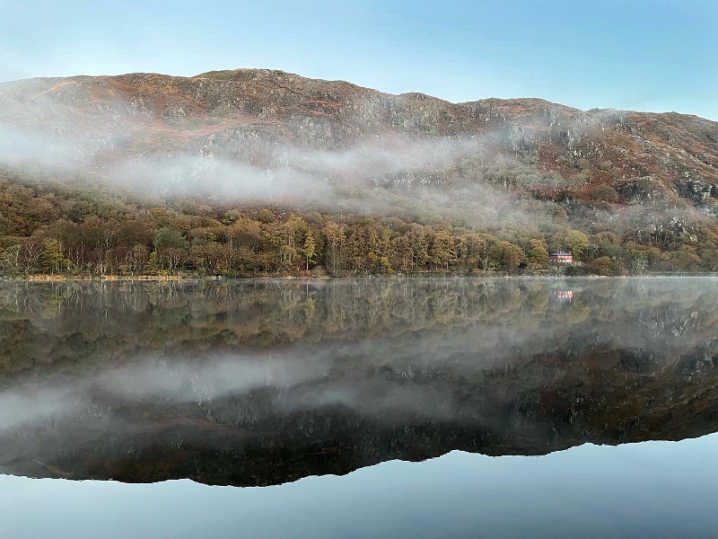
This route is ideal for a gentle stroll through woodland, along the banks of lake and river as it takes in Llyn Dinas and Afon Glaslyn before following leafy lanes to Beddgelert.
|
Start location |
Watkin Path car park next to A498 (Toilets at car part, not open 24 hours) |
|
Start grid reference |
SH 628 507 |
|
Length |
10.6 kilometres (6.6 miles) |
|
Total ascent |
225 metres (740 feet) |
|
Typical duration |
2 hour 40 mins |
|
Suitable for |
Sunday strollers |
BEDDGELERT FOREST LOOP
Featured in: Walks in and around Nantgwynant
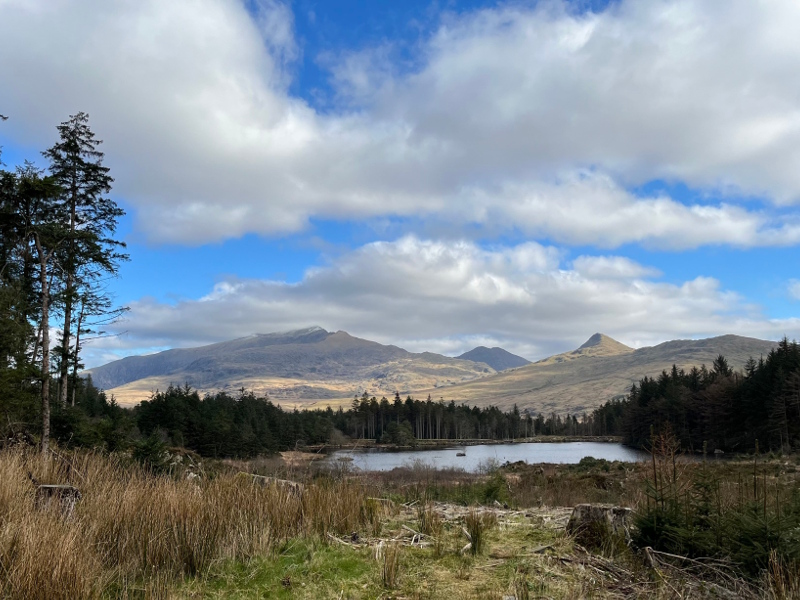
Note that this route is detailed with a starting point in Beddgelert, however it can be combined with the route “Nantgwynant to Beddgelert along the Afon Glaslyn” which passes through woodland, along the side of Llyn Dinas, the banks of Afon Glaslyn and leafy lanes to reach Beddgelert (described above) for walkers who wish to start walking from Nantgwynant.
The (river) Afon Glaslyn has its source flowing from a lake high up on Yr Wyddfa (Snowdon), flows through Nantgwynant and Beddgelert and enters the Irish Sea at Porthmadog.
After crossing the open mountainside at the foot of Moel Hebog the route then follows Beddgelert Forest trails which, through gaps in the trees, provide fine views of many mountain ranges.
The route also visits Llyn Llywelyn below Moel Lefn (which in fine weather provides a great spot to stop for a snack or a small picnic).
The return section of the route follows close to sections of the Welsh Highland Railway with glimpses of picturesque little stations at Meillionen and Beddgelert.
Meillionen Station is a quaint railway station which was opened 8 April 2009, primarily to serve people staying at the camp site near by.
The route follows mainly tracks and good paths, with a short section of steeper forest footpath next to a stream (Afon Meillionen).
|
Start location |
Central Beddgelert car park next to the Welsh Highland Railway station (Toilets at car part, not open 24 hours) |
|
Start grid reference |
SH 588 481 |
|
Length |
12.2 kilometres (7.6 miles) |
|
Total ascent |
381 metres (1250 feet) |
|
Typical duration |
3 hours 30 mins |
|
Suitable for |
Sunday strollers looking for a longer walk |
BEDDGELERT, ABERGLASLYN PASS, NANTMOR LOOP
Featured in: Walks in and around Nantgwynant
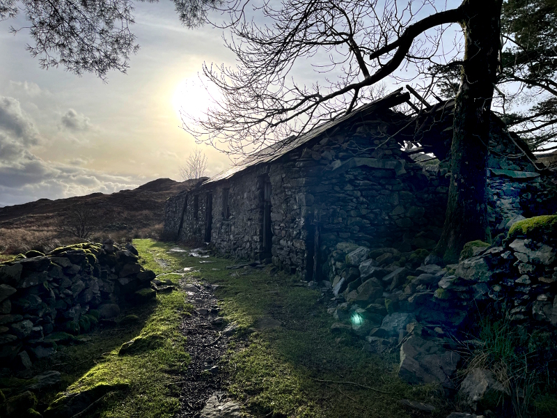
Note that this route is detailed with a starting point in Beddgelert, however it can be combined with the route “Nantgwynant to Beddgelert along the Afon Glaslyn” which passes through woodland, along the side of Llyn Dinas, the banks of Afon Glaslyn and leafy lanes to reach Beddgelert (described above) for walkers who wish to start walking from Nantgwynant.
This route first climbs steadily, and, after the initial section, crosses open mountainside (which can be boggy in places after periods of rain) with views over Beddgelert and of the mountains beyond, before descending along a rocky path through woodland to Afon Glaslyn, following a riverside trail back to the start.
|
Start location |
Central Beddgelert car park next to the Welsh Highland Railway station (Toilets at car part, not open 24 hours) |
|
Start grid reference |
SH 588 481 |
|
Length |
7.3 kilometres (4.5 miles) |
|
Total ascent |
322 metres (1055 feet) |
|
Typical duration |
2 hours 15 mins |
|
Suitable for |
Competent navigators |
GELERT’S GRAVE AND RIVERSIDE LOOP
Featured in: More walks in and around Nantgwynant
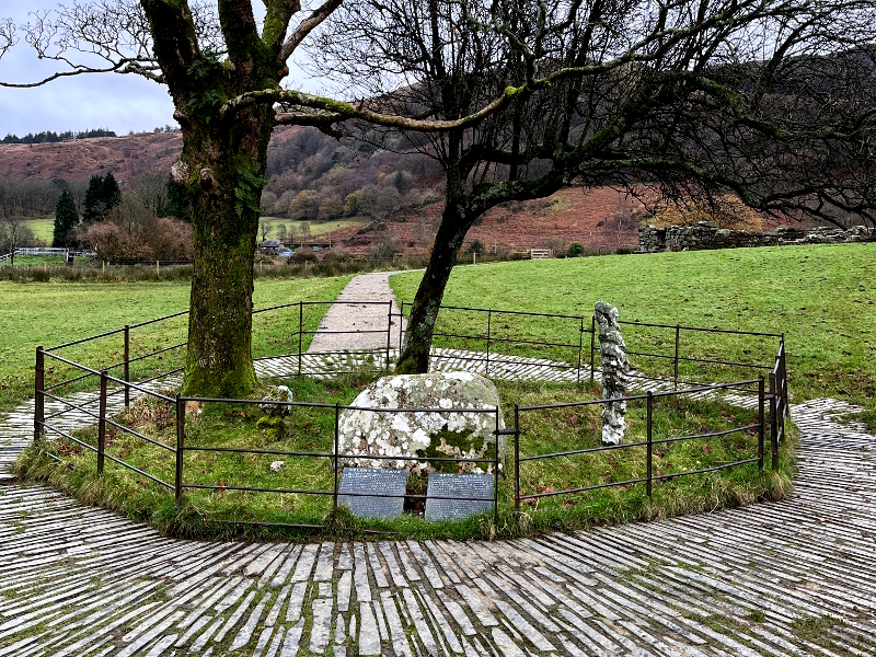
This mainly level walk passes the historic grave of Gelert, the brave dog of the 13th century prince Llywelyn the Great, from which the village of Beddgelert takes its name (translating from Welsh as the grave of Gelert), it also passes the site of an Augustine Priory, the current village church and includes a section of riverside.
If you’re lucky you might glimpse a steam train on the Welsh Highland Railway, this section of which was built to carry the extracts of local mines and quarries to the port at Portmadog.
|
Start |
Central car park in Beddgelert (next to the railway station) |
|
Distance |
2.8 km |
|
Altitude Gain |
55m |
|
Approx Time |
50 mins |
|
Rating |
Sunday strollers |
BEDDGELERT SOUTH LOOP
Featured in: More walks in and around Nantgwynant
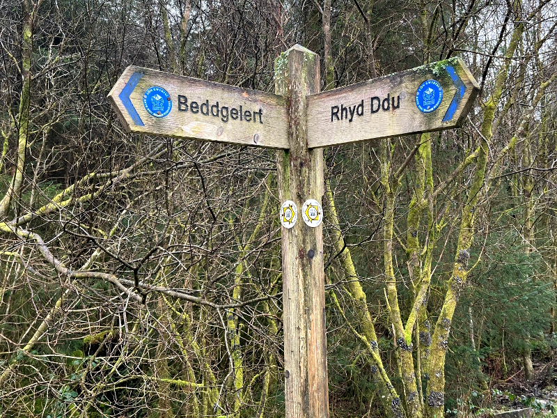
This walk starts with an up hill section over open countryside before levelling out to follow tracks and then lanes back to the village centre, passing on the way the old Beddgelert railway station. On a clear day there are views over the village to the mountains beyond.
|
Start |
Central car park in Beddgelert (by railway station) |
|
Distance |
2.6 km |
|
Altitude Gain |
90 m |
|
Approx Time |
45 mins |
|
Rating |
Sunday strollers |
A little futher from Nantgwynant
A LITTLE FURTHER FROM NANTGWYNANT
Only a short car journey from Nantgwynant these walks offer additional options for those looking to explore a little further.
Some of the highlights in these areas:
- Old woodlands
- Beddgelert forest trails close to Rhyd Ddu
- Fine views of mountain summits and ridges on a clear day
- Welsh Highland stream railway
- Llyn y Gadair
NANTMOR LOWLAND LOOP
Featured in: More walks in and around Nantgwynant
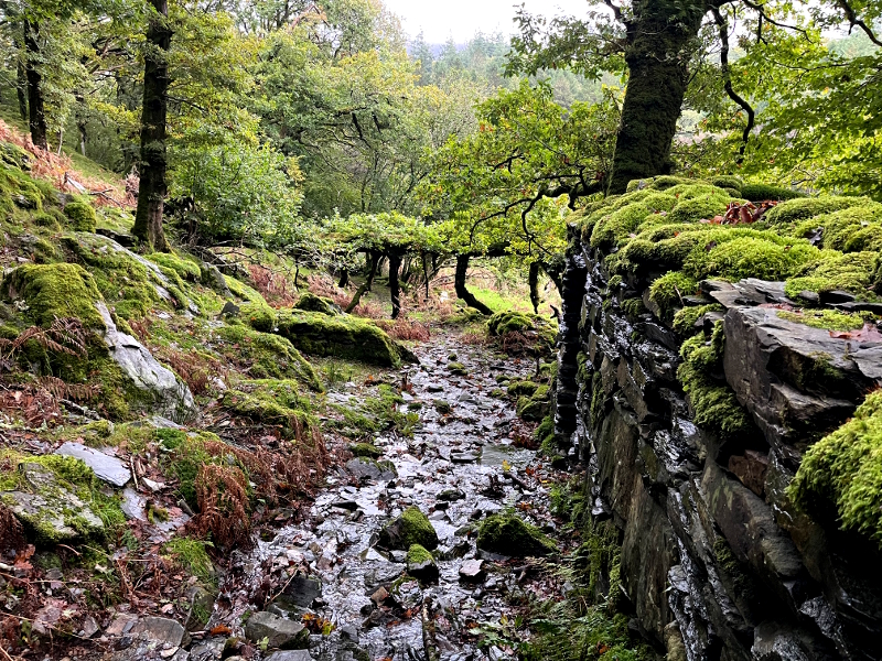
This gently undulating walk along lanes, across farmland and through woodland is a country walk with views of the surrounding mountains.
This walk could be combined with walk ‘LLYN DINAS TO ABERGLASLYN LOOP’ from the first book 'Walks in and around Nantgwynant' to start from ‘Watkin Path car park in Nantgwynant’ to make a circular walk of 15.6km, with an additional 42 metres of ascent and lasting an total approximate time of 5 hours to include sections of the Afon Glaslyn river with its rapids interspersed with wider calmer sections.
The (river) Afon Glaslyn has its source flowing from a lake high up on Yr Wyddfa (Snowdon), flows through Nantgwynant and Beddgelert and enters the Irish Sea at Porthmadog.
|
Start |
Nantmor woodland car park |
|
Distance |
6.6 km |
|
Altitude Gain |
240 m |
|
Approx Time |
2 h |
|
Rating |
Enthusiastic wanderers |
RHYD DDU AND BEDDGELERT FOREST LONG LOOP
Featured in: More walks in and around Nantgwynant
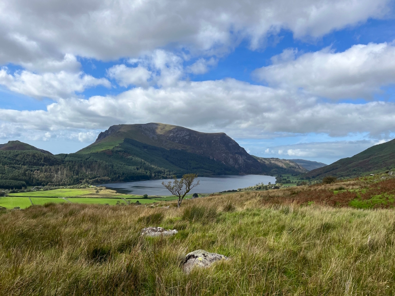
Starting over the lower foothills of Yr Wyddfa (Snowdon) this gently undulating walk then descends to the Beddgelert Forest to follow forest tracks which at times offer fine view of surrounding mountains and picturesque forest glades, visiting the forest lake (with picnic area) of Llyn Llywelyn before returning via the old Cadair Wyllt slate quarry and the nature conservation area around Llyn y Gadair. The route passes through Rhyd Ddu.
|
Start |
Rhyd Ddu car park |
|
Distance |
11.7 km |
|
Altitude Gain |
293 m |
|
Approx Time |
3 h 30 min |
|
Rating |
Enthusiastic wanderers |
RHYD DDU AND BEDDGELERT FOREST SHORT LOOP
Featured in: More walks in and around Nantgwynant
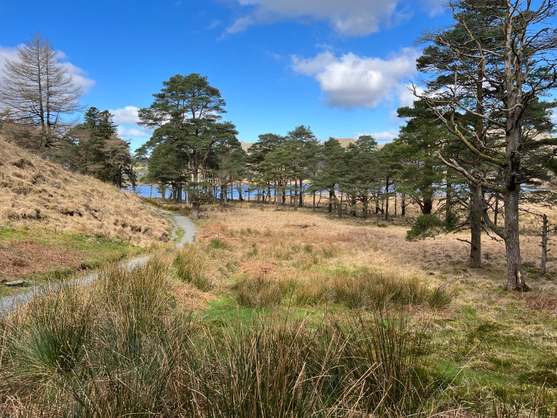
A shorter version of the Rhyd Ddu and Beddgelert Forest Long Loop, still starting out over the lower foothills of Yr Wyddfa (Snowdon) this gently walk descends to the Beddgelert Forest to follow a level section of the Snowdonia Slate Trail along forest tracks returning via the old Cadair Wyllt slate quarry which was operational between 1885 and 1920 and the nature conservation area around Llyn y Gadair. The route passes through Rhyd Ddu
|
Start |
Rhyd Ddu car park |
|
Distance |
6.5 km |
|
Altitude Gain |
170 m |
|
Approx Time |
2 h |
|
Rating |
Sunday strollers |
Your own adventures
... every day is different!